-
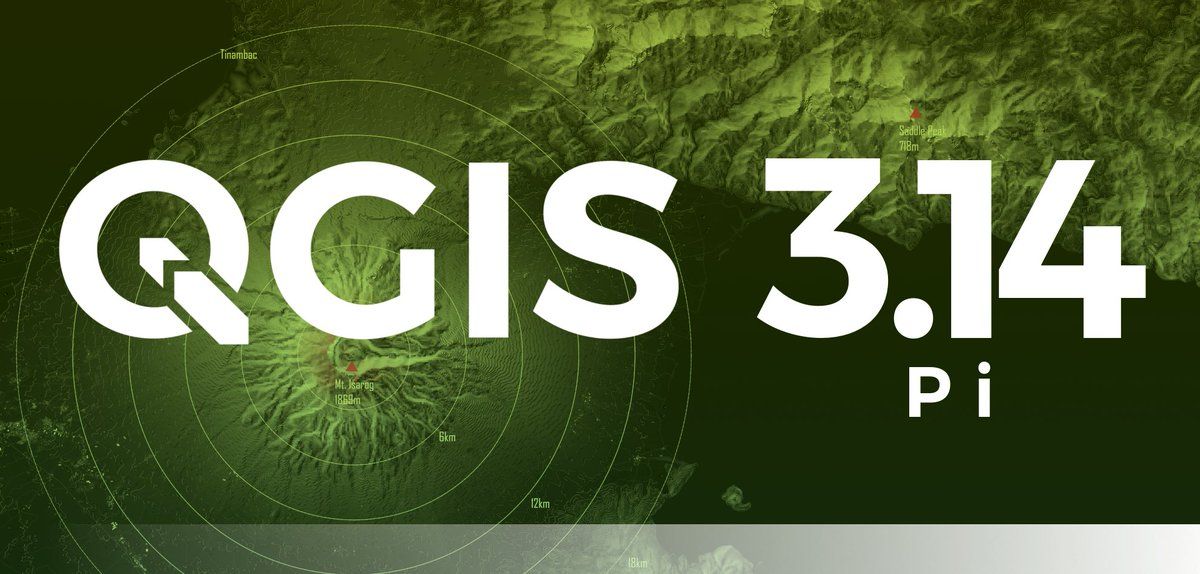
Congratulations to Francis Josef Gasgonia for winning the #QGIS Pi Mapping Contest! blog.qgis.org/2020/06/13/qgis-pi-mapping-contest-results/ And thanks to all participants who submitted designs to ensure that QGIS 3.14 will have great visuals!On twitter.com
 ♻️ 101 Retweets
❤️ 342 Favorites
Mood +12 🙂
♻️ 101 Retweets
❤️ 342 Favorites
Mood +12 🙂
-
Francis writes about his submission: “This map would not be complete without the use of Pi. Multicentric ring buffers represent potential danger zones in this map of Mt. Isarog in the Philippines. [1/3]Permalink On twitter.com
❤️ 15 Favorites
Mood -2 🙁
-
The calculations necessary to develop the ring buffers depend on Pi. Mt. Isarog is classified as a potentially active stratovolcano. [2/3]Permalink On twitter.com
♻️ 1 Retweets
❤️ 14 Favorites
Mood +1 🙂
-
This map best represents the use of Pi in a map because these buffers are crucial in disaster planning, especially now in a Covid-19 pandemic world; wherein ring buffers, and other types of buffers are in use for humanitarian and logistics planning.” [3/3]Permalink On twitter.com
♻️ 1 Retweets
❤️ 16 Favorites
Mood +1 🙂